Laupāhoehoe, Hawai‘i
The Hakalau Remote Automated Weather Station (RAWS) station is jointly operated by the Fish and Wildlife Service’s Hakalau Forest National Wildlife Refuge and the National Interagency Fire Center (NIFC) of the Forest Service. To learn more about RAWS click here. The station is located at an elevation of 6,400 feet (1,951 m) above sea level and has been in continuous operation since 2002. Besides precipitation, a number of other climatic data is collected by the station. These include, solar radiation, wind speed and direction, wind gust speed, average, minimum, and maximum air temperature and relative humidity, and evapotranspiration.
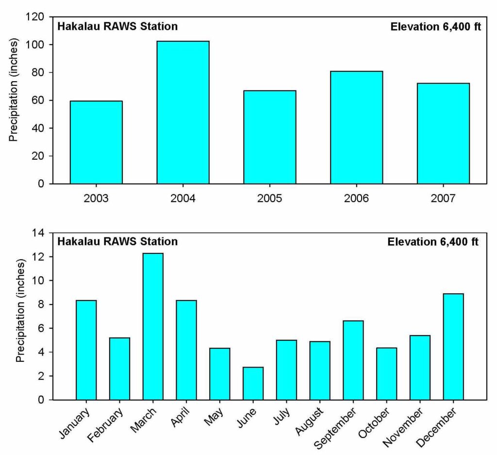
Data from the station is available from NOAA’s Western Regional Climatic Data Center and can be downloaded here. Average annual precipitation for the site is 76 in (1,940 mm). Longer term (41 year) precipitation records from the NOAA cooperative Keanakolu Camp station located nearby show similar patterns of precipitation. Normal, 41-year annual rainfall is about 69 inches (1,752 mm), slightly drier than the past 5 years at Hakalau.
The first set of graphs below show the total annual and average monthly precipitation for the Hakalau RAWS station from 2003-2007. Rainfall can be extremely variable from year to year, however these five years have seen normal precipitation patterns.
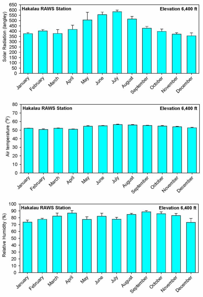
The second set of graphs show show average monthly solar radiation, air temperature, and relative humidity (error bars are standard errors) from 2003-2007. As is expected, the summer months show higher solar radiation and higher average air temperatures. Relative humidity is only slightly lower during the drier summer months.
The downloadable file below contains copies of the graphs, the daily RAWS data files, metadata for the station, and some summary data we have prepared.
Data (click to download data file)